Archaeologists discover a network of more than 4,000 canals and 700 farms in Eridu
Latest News
Reported by La Brújula Verde:
In the heart of ancient Mesopotamia, a group of researchers has achieved a significant archaeological milestone: the identification and mapping of a vast network of irrigation canals in the region of Eridu, in southern Iraq, the southernmost of all the great Mesopotamian cities and, according to the Sumerian King List, the oldest city in history.
The research, conducted by a multidisciplinary team of archaeologists and geologists from various universities and international institutions, confirms that the Eridu region, inhabited from the sixth to the first millennium BCE, preserves one of the oldest and best-preserved irrigation networks in Mesopotamia.
Historically, Mesopotamia has depended on the Euphrates River and its tributaries for crop irrigation. The ability to divert water from these rivers through canals was essential for the sustainability of urban settlements. However, most ancient irrigation structures have been buried under fluvial sedimentation or replaced by networks from later periods, making it difficult to study the earliest agricultural systems in detail.
Unlike other areas, the Eridu region was abandoned after a shift in the course of the Euphrates, allowing its archaeological landscape to remain relatively intact. This exceptional situation has enabled researchers to precisely identify and map a complex network of artificial canals predating the first millennium BCE.
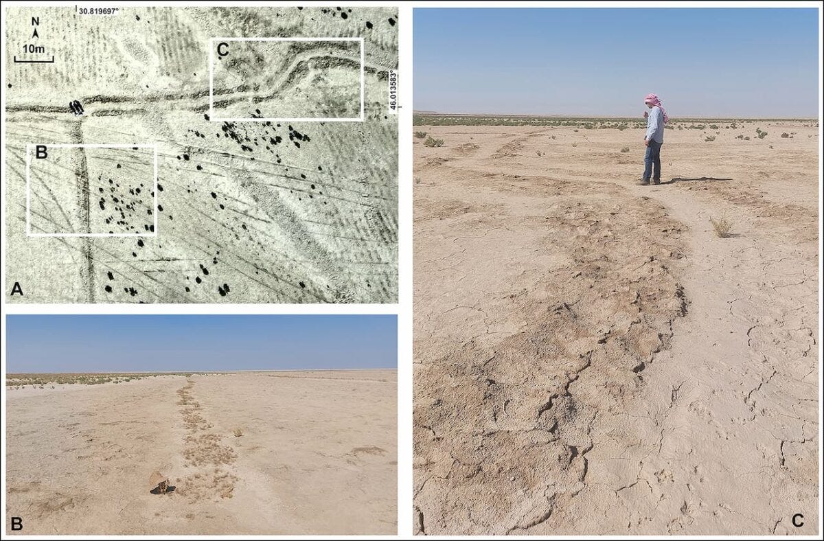
For this study, archaeologists used an interdisciplinary approach combining geomorphological analysis, historical map reviews, and remote sensing technology. High-resolution satellite imagery, including images from the 1960s CORONA program, drones, and ground photography, were used to validate the findings.
One of the key methods for distinguishing natural canals from artificial ones was the analysis of water flow patterns, topography, current directions, and the presence of hydraulic control structures such as dikes and natural or artificial breaches in river dikes that allowed controlled water distribution over the floodplain.
Read more here.


I have a question, because I've also seen Jericho described as the world's oldest city, or sometimes rephrased as a "settlement" (per the Britannica entry below, for example). How exactly do archaeologists define the term "city"? Is it in terms of the number of buildings, irrigation networks (suggesting attempts at agriculture), population, etc? Because again Jericho dates back to roughly 11,000 - 9,000 BC. What does the Eridu civilization have that Jericho does not?
I'm fascinated by how such terminology shapes our understanding of history!
https://www.britannica.com/place/Jericho-West-Bank